UPDATE:
The watch is now a warning as the snow starts to fly in the Bulkley Valley, Lakes District and east to the Alberta border.
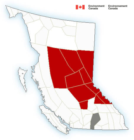
The predicted snowfall amount has been increased to 30-40 cm by Saturday morning. The closer to the border, the more snow in the forecast, with areas around Highway 16 east and north of Prince George expecting 50 cm.
Environment Canada adds that as the frontal system collides with an advancing arctic cold front late Thursday, strong winds will develop over parts of the northern interior generating poor visibility in blowing snow.
Snow will abate on Saturday as dry Arctic air settles in. Then it gets cold and sunny, with highs in the mid-minus-teens and lows around minus 22 for the weekend and into Monday.
––
Environment Canada has put a winter storm watch in effect for Bulkley Valley, the Lakes District and the rest of the Highway 16 corridor east to the Alberta border.
A long duration snowstorm is forecast to begin on Thursday. A slow moving frontal system will spread snow across the B.C. central interior beginning Thursday morning. Snow is expected to continue falling Thursday night and Friday and will likely persist over some regions until the front moves into Alberta early Saturday.
Total snowfall amounts will range from 15 cm up to as high as 30 cm by Friday morning.
Environment and Climate Change Canada meteorologists are monitoring the situation and this winter storm watch may be upgraded to a warning as the forecast becomes more certain.
Rapidly accumulating snow could make travel difficult over some locations. Poor weather conditions may contribute to transportation delays.
To report severe weather to Environment Canada, send an email to BCstorm@canada.ca or tweet reports using #BCStorm.
04:04 EnvCanada issued watch #WinterStorm #Smithers #BCStorm https://t.co/Wl7DqRC10q
— Smithers (@ECAlertBC82) January 30, 2019