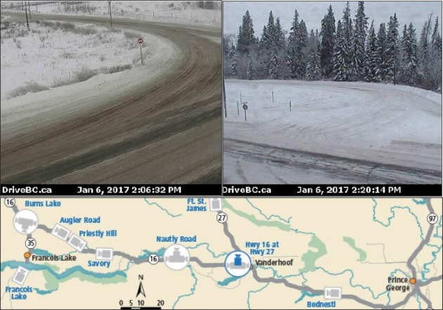
Drivers travelling between Vanderhoof and Fraser Lake can now preview road conditions from two new webcams on Highway 16.
Installed at Highway 27 and Nautly Road, the new webcams provide north, east, and west views of the intersections and are two of the four new webcams along Highway 16: one in Burns Lake at North Francois Highway and another in Telkwa at Hankin Road.
Images taken from the webcams, refreshed every few minutes, can be found on http://www.drivebc.ca/#webcams
Along with six new bus shelters installed in communities including Vanderhoof, Fraser Lake, Wet’suwet’en First Nation, Moricetown, Gitaus, and Kitimat, the new webcams are part of the B.C. government’s $5-million Highway 16 Transportation Action Plan.
“Together with our federal partners, we are dedicated to making this northern corridor with many small local governments and First Nations communities safer for all who travel along it.
“In particular we are committed to improve personal safety for women and teenaged girls,” said John Rustad, Minister of Aboriginal Relations and Reconciliation and MLA for Nechako Lakes, on behalf of Todd Stone, Minister of Transportation and Infrastructure, in a statement.
“Providing new webcams and bus shelters along the highway is another important element of our $5-million action plan, which includes introducing new transit services and a community vehicle program in early 2017.”